•
Port-au-Prince
•
Cap-Haïtien
•
Gonaïves
•
Jacmel
•
Jérémie
•
Les Cayes
•
Port-de-Paix
•
Hinche
•
Fort-Liberté
★
★
★
★
★
★
★
★
★
Cities
Landmarks
Haiti Map Explorer
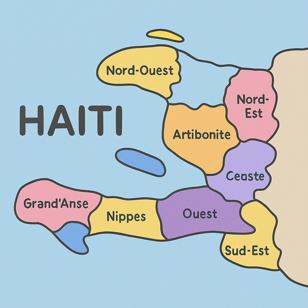
Click on any department on the map to learn more about it. The map shows Haiti's 10 departments, each with a different color.
Did you know?
Haiti is divided into 10 departments (administrative divisions), similar to states or provinces in other countries.
Explore the map to learn about Haiti's geography, major cities, and important landmarks!
About Haiti
Haiti occupies the western third of the island of Hispaniola, which it shares with the Dominican Republic. It is a mountainous country with coastal plains and is divided into 10 administrative departments.
The country has a rich history as the first independent Black republic in the world, gaining independence from France in 1804. Haiti's geography includes beautiful beaches, mountain ranges, and diverse ecosystems.